Atwater Site SNOWPACK Demonstration Page
Link to DEID storm data.
These are some example snowpack profiles for the Atwater site in Alta, Utah computed using the SLF's SNOWPACK simulation tool.
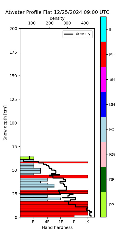
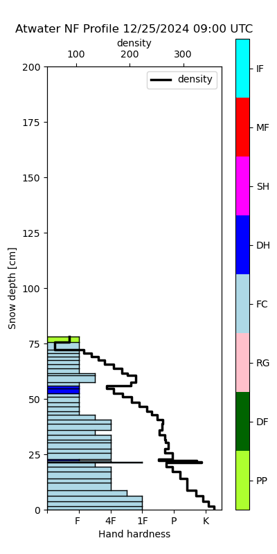
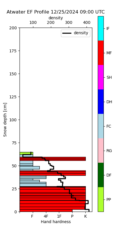
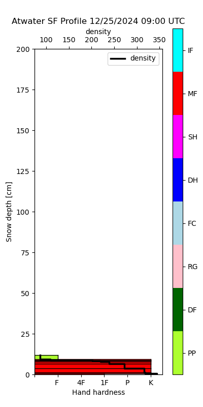
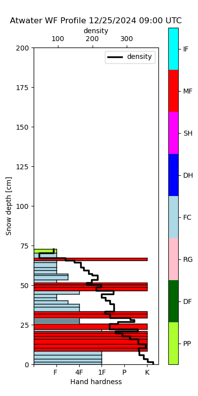
Figure 1: Today's snowpack profiles for a flat slope, north-facing 35 degree slope (NF), east-facing 35 degree slope (EF), south-facing 35 degree slope (SF) and west-facing 35 degree slope (WF).
Simulations are driven using data from the Alta Atwater Snowstudy Plot. Symbols: rFC - rounding facets, IF - ice formation, MF - Melt freeze, SH - surface hoar, DH - depth hoar, FC - faceted crystals, RG - rounded grains, DF - decomposing and fragmenting particles, PP - precipitation particles. Note that the time is in UTC. Local Utah time is UTC -7 hours.
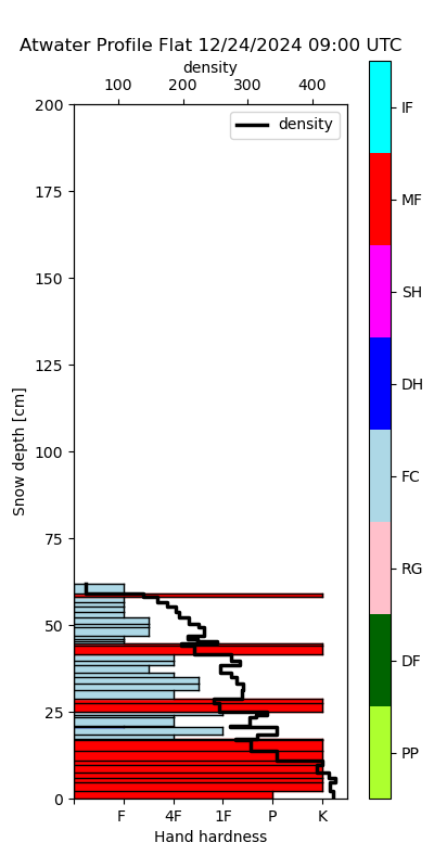
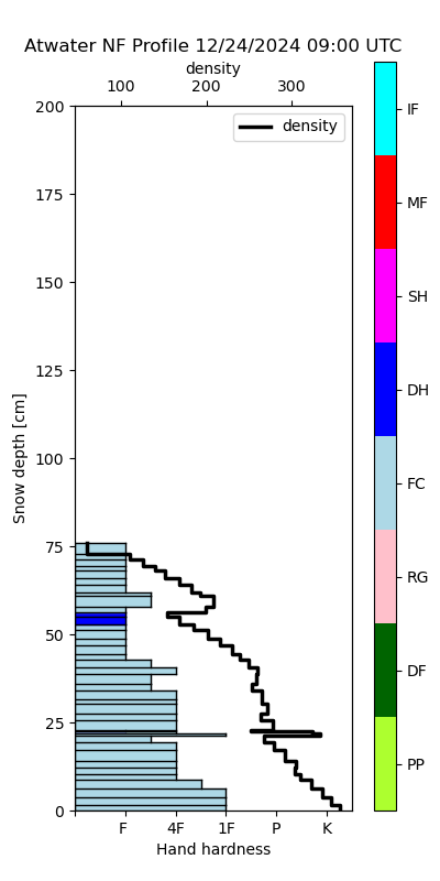
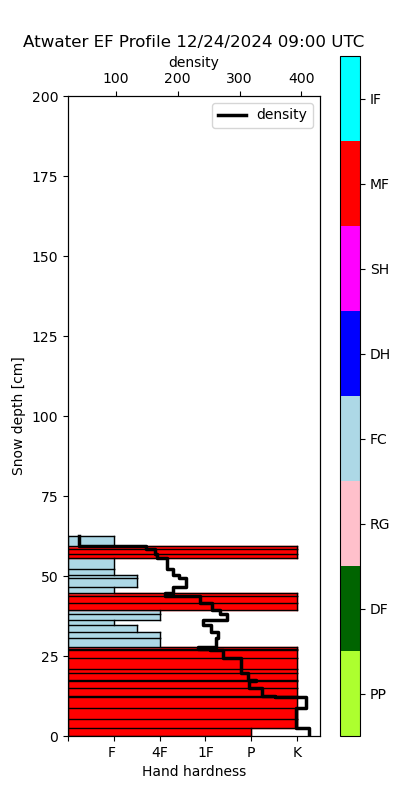
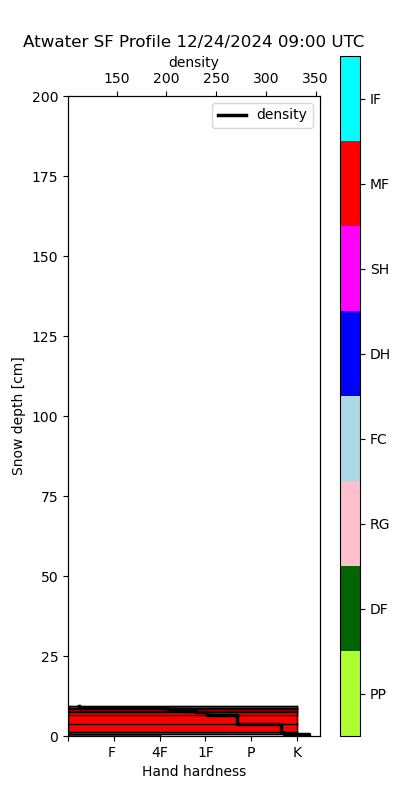
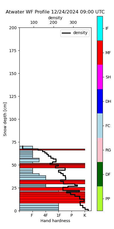
Figure 2: Yesterday's snowpack profiles for a flat slope, north-facing 35 degree slope (NF), east-facing 35 degree slope (EF), south-facing 35 degree slope (SF) and west-facing 35 degree slope (WF).
Simulations are driven using data from the Alta Atwater Snowstudy Plot. Symbols: rFC - rounding facets, IF - ice formation, MF - Melt freeze, SH - surface hoar, DH - depth hoar, FC - faceted crystals, RG - rounded grains, DF - decomposing and fragmenting particles, PP - precipitation particles. Note that the time is in UTC. Local Utah time is UTC -7 hours.
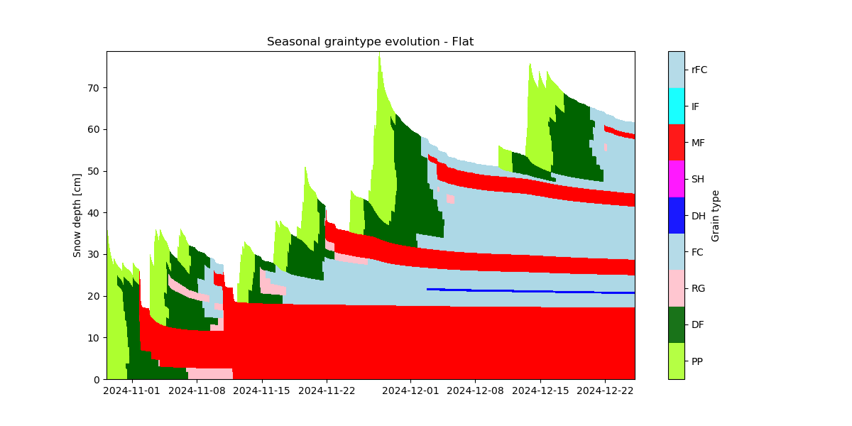
Figure 3: Evolution of grain type throughout the season at the Atwater site for flat terrain.
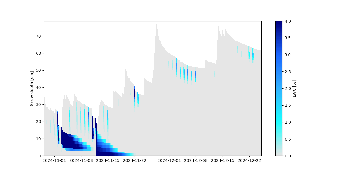
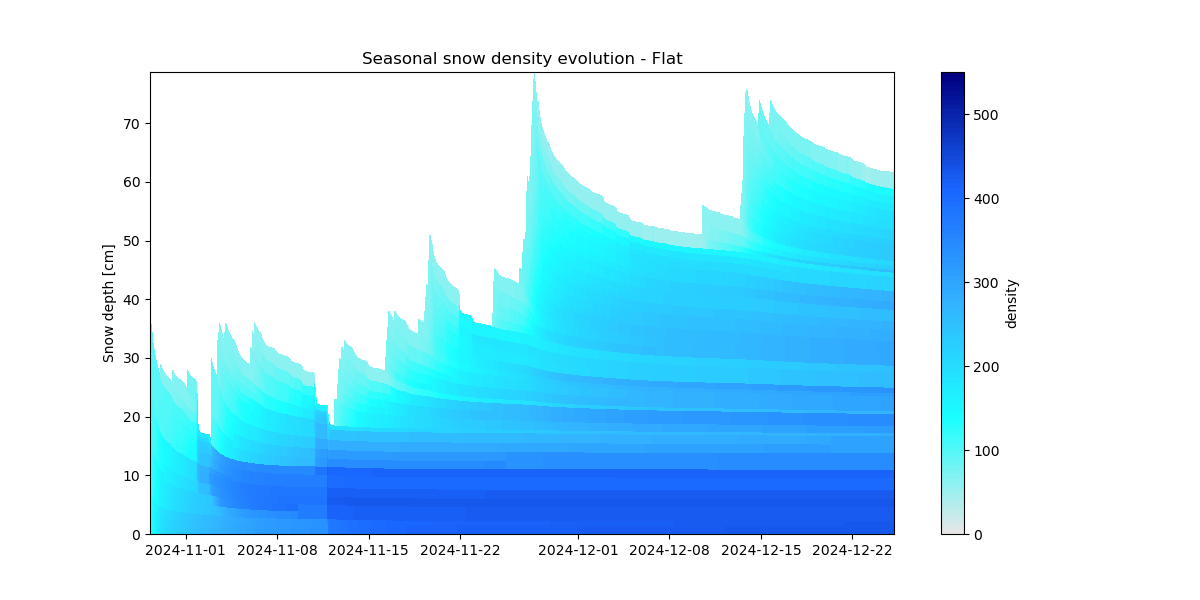
Figure 4:(left) Evolution of liquid water content in the snow and (right) snow density, throughout the season at the Atwater site for flat terrain.
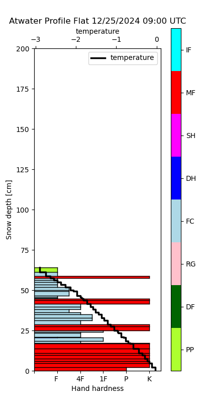
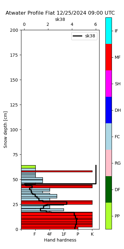
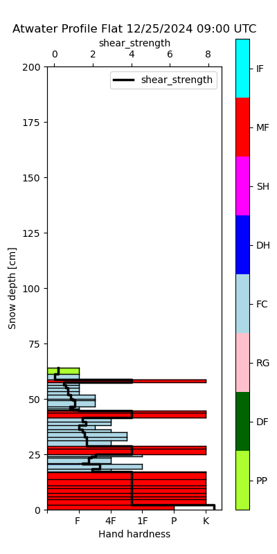
Figure 5: Profiles of (left) snow temperature (°C), (center) skier stability index - SK38, and (left) shear strength (kPa) for today at the Atwater site for flat terrain.


