
Parameterization of the land-surface thermal and moisture heterogeneities
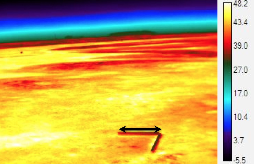 Surface temperature fluctuation video made by Tim Price
Supported by the National Science Foundation - AGS 1649067
Investigators, Senior Personnel, and Collaborators:
Eric Pardyjak (Utah, Principal Investigator)
Marc Calaf (Utah, Co-Principal Investigator)
Marcu Hultmark (Princeton University, Co-Principal Investigator)
Students:
Travis Morrison
Fabian Margaraiz
Alexei Paralet
This study seeks to create new fundamental knowledge and computer model representations for atmospheric simulations in regions where the land presents large thermal and moisture differences. The investigators will first conduct a high-resolution field experiment using transformative measurement techniques over the playa in Utah's West Desert, where the terrain is characterized by a relatively uniform rough surface with differences in both space and time of surface temperature and soil-moisture. Results from this field experiment will be used to: (1) investigate the time/space structure of the surface temperature and moisture fluctuations and (2) formulate new relationships or corrections that account for the differences in surface temperature and moisture. The research seeks to address the challenges in representing heterogeneities in the Atmospheric Surface Layer (ASL) at finer scales where spatial averaging cannot be used to provide homogeneous fields. Field data will be collected over the Utah Playa, an area with relatively flat terrain and, presumably, uniform roughness; but variable temperature and soil moisture. The goal of this study is to run simulations at 100-meter (m) resolution using field data collected under weak stratification to develop new Large Eddy Simulation (LES) parameterizations; with anticipated improvements of 20%. The main hypothesis being tested is that the spatial structure of temperature and moisture variations will be represented in the detailed flux measurements, even over flat terrain. Results will be tested in both LES and mesoscale models. Initial experiments will be conducted for bare, dry soil conditions. The broader impacts include outreach and education activities with the public; as well as the potential to improve model parameterizations for numerical weather prediction models.